Integrated Signage at Wadi El Gemal National Park
This project was for designing and implementing an “Integrated Signage Plan” for Wadi El Gemal National Park which would adhere to the architectural character of the park’s infrastructure which we established in a previous project.
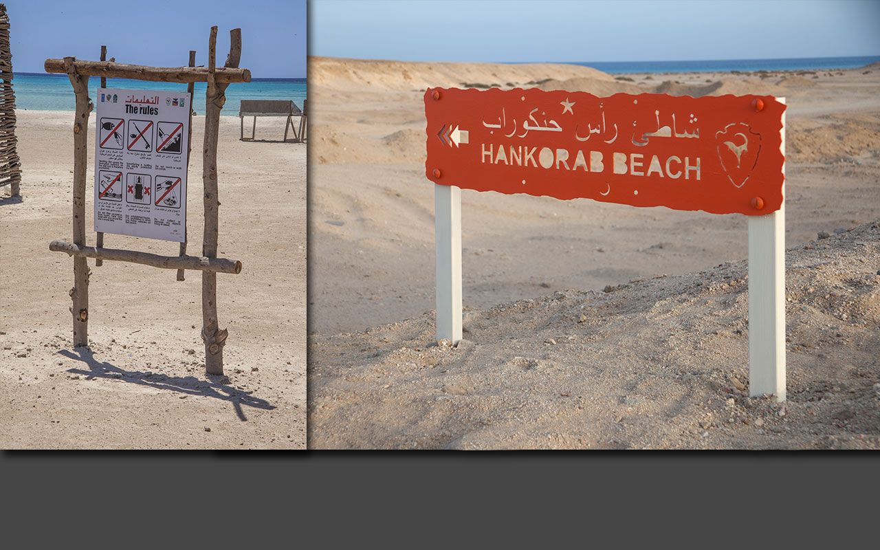
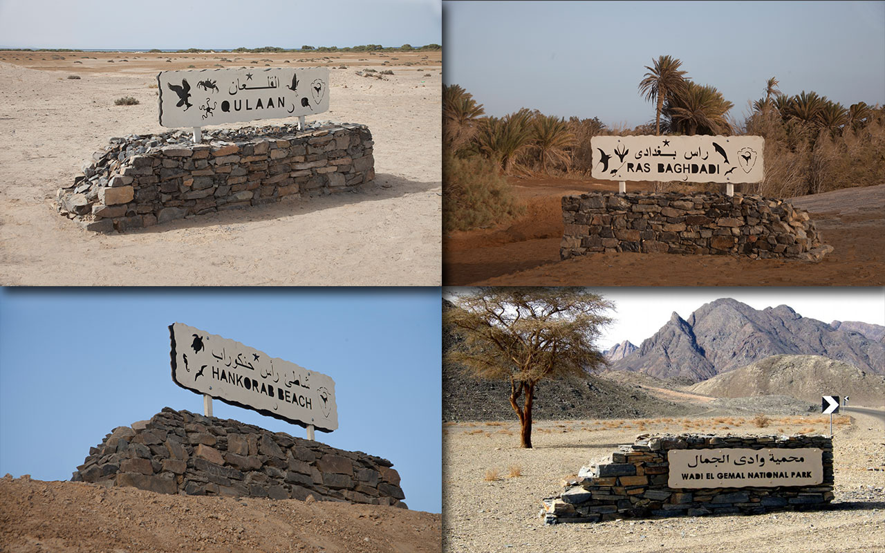
This included directional, behavioural and interpretive signage which was placed at select locations which exhibit key natural, cultural or historical points of interest. The interpretive signage are located in the following locations:
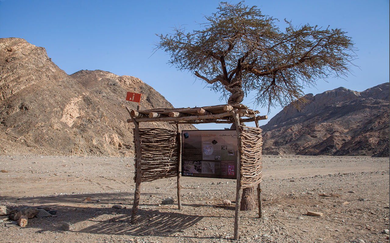
1. Sikeit archeological site. Mons Smaragdus (emerald mountain) is composed of around nine small mining communities, with the one in Wadi Sikeit representing the most important archaeological site, due to the large temple carved into the body of the mountain.
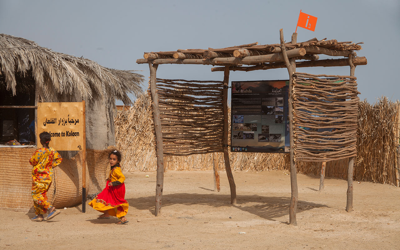
2. Qullan Village. This Ababda fishing village is located around a splendid mangrove bay and represents one of the most distinctive local communities in the park. This exhibit features the native Ababda and their rich culture. It also exhibits the mangrove eco-system and its importance along with the diverse marine, mammal and bird species which depend on it. The interpretive sign for this location would be place inside the existing shelter.
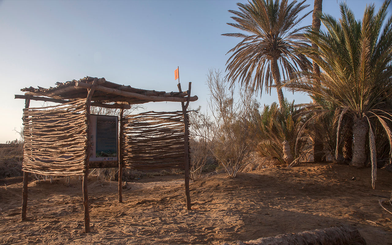
3. Ras Baghdadi Wetland; exhibits the delta which was formed from alluvial sediments brought down through Wadi El Gemal. The mountain watershed meets the seawater creating a salty marsh. In addition to the Dom Palms, Acacia trees and other plants that grow there, this pictur¬esque land is a habitat for foxes, wildcats, gazelles…etc.
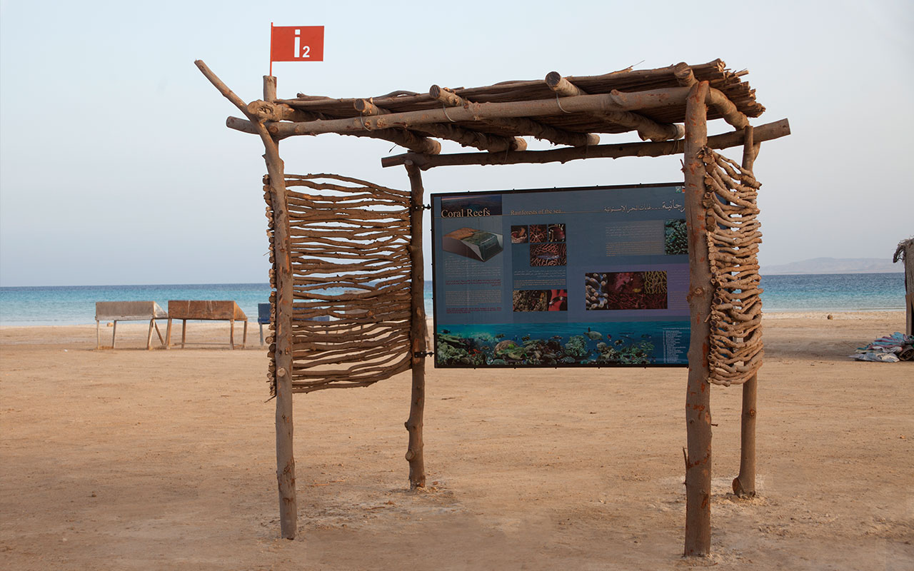
4. Hankorab Beach. This interpretation post exhibits the splendid fringing and offshore coral reefs along the park’s pristine coastline. It is located within the eco beach facilities we performed at that site.
* The construction of these facilities was made possible with the support of EEAA, UNDP, SEPA and EPASP.